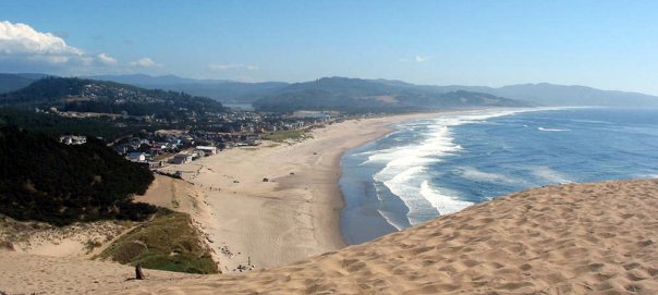
Tuesday, September 25, 2012

Quiet time in Lotus, California

Tuesday, 25 September.  Today was a "quiet" day, a day of rest for us old farts.  Once in awhile its just nice to be lazy and do nothing.  Plus my bad knee/leg was acting up after the full day of walking during our Sonoma/Napa wine country sightseeing outing, so, a good day to let it rest. Spent most of the day working on this blog, so its pretty up to day, except for this entry.  We drove into Placerville (about 8 miles and 16 minutes away on a winding, curvy road) for a good country home-cooked dinner at the Buttercup Pantry.  After a little grocery shopping at the local Safeway - we're having Laren & Teena out here for grilled hamburgers tomorrow afternoon - we headed back to the TT Ponderosa campground.  It was a very pleasant evening - temps in the low 70's - so we opted to uncork one of the bottles of dessert wines we keep chilled and sit outside and relax.  I let Lynette pick and she choose a nice Rhuburb Liqueur from the It's 5 O'Clock Somewhere winery in Cashmere, Washington.  So we poured a nice glass for each of us, took a sip, and immediately knew that 5 O'Clock brandies and dessert wines have a nice alcohol content; in this case, oh, about 25% by volume or just over 50 Proof  We definitely needed smaller glasses or needed to cut this stuff with some soda water or 7Up.  A very nice drink, but a "sipping" drink, for sure.  Our campsite is right on the American River as it flows by the campground and we're right in front of some rapids.  Sitting out under the stars - so bright and so many of them - made for a very enjoyable evening.

Believe the plan tomorrow is for Laren & Teena to come out to the campground around 10:30, and then we'll head over to Placerville for some sightseeing.  Placerville (aka Old Dry Diggings, Dry Diggings, and Hangtown) is the county seat of El Dorado Country and has about 10,400 people. When gold was discovered in nearby Coloma (our campground is just a mile north of this small town) in 1848 - sparking the California Gold rush - Placerville was known as Dry Diggin's after the way the gold miners moved cartloads of dry soil to running water to separate the gold from the soil. In 1849, the town earned its most common historical name, "Hangtown", because of the numerous hangings that occurred there.
This "criminal" still hangs from a house on Placerville's main street. We wondered what the smell was the whole time we were in town!

By 1850, a few local churches requested a more friendly name be bestowed upon the town. The name was not changed until 1854 when the City of Placerville was incorporated; at that time, Placerville was the third largest town in California.  The town became a central hub for the Mother Lode region's mining operations. As you might expect, Placerville is a historic community from the gold-rush days, with many old buildings from this period; a walk down Main Street today reveals many historical markers, signifying spots of certain events or persons of importance during this period. Placerville was also on the line of the Pony Express, the short-lived mail carrier service that connected California to the Midwest and East...basically from Sacramento to St Joseph, Missouri.

Photos of historic buildings in Placerville


Sonoma wine country, White Fang, and Yeti


Saturday, 22 September We began our visit in this part of the country by driving over to Citrus Heights (population about 80,000) and the lovely home of my brother, Laren, and his wife Teena. I always look forward to visits with my brother, since we don't often have the chance to get together.  I left home to join the Air Force (AF) when I was 21 and Laren was entering his junior year in high school.  While growing up in Yakima, Washington, we were close as brothers; however, once I left home and began my globe hopping from one AF assignment to another, Laren and I starting drifting apart, not staying in touch as often as I think we both would have liked.  Over the past several years I believe we've tired to change that pattern. Actually we both have very similar interests.  We both have history degrees and have studied languages.  I was a Romanian and German linguist during my early AF career, and even picked up a few hundred specialized vocabulary words of Russian tactical air terminology while stationed in Berlin in the early '70's.  Laren studed Chinese Mandarian in college, later spent an intensive semester at the University of Washington studying Japanese, and then spent two years in the Peace Corps assigned to Korea, which meant he also studied the Korean language.  He still returns to Korea every few years to travel and visit Korean friends, and is in the last stages of writing a book on Korean temples associated with that country's Shamanism.  Today Laren is the Deputy State Archivist at California's State Archives, and even met his wife, Teena - also an archivist and history buff - while at the Archives.  Teena is a joy to have along when we visit and sightsee any of California's historic sites throughout this part of the state.   Anyway, I am looking forward to some quality time with the only brother.   For this first evening together, Laren grilled some beef Tri-Tip and Teena fixed a wonderful dinner. A great ending to our first day's visit to the Sacramento area.
Sunday, 23 September – Went over to Laren and Teena’s about 9:30am. Lynette and Teena took off for a Citrus Heights Sunday Fun Day, an annual community activity; Teena had invited Lynette to help her man a both for the day-long event.  With the ladies off doing their own thing,  Laren and his son, Ryan, and I took off for an amusement park over in Roseville to play some miniature golf. While this was entirely a "friendly" match, the loser was obligated to buy lunch at a nearby Irish pub.  While the competition was hot and heated at times, with much poking of fun, youth won out in the end and Ryan soundly defeated his dad and uncle.   And, oh yes, I manged to sink a couple more pressure-packed putts and narrowly defeated my dear brother.  We ended this manly outing over a delicious lunch and brews, while watching the Niners lose to the Vikings.  What a terrible loss for San Francisco.  But, oh man, did that food taste great, Laren!

We returned home just in time to see the ladies also returning.  Guess the Sunday Fun Day went just fine, although per Teena, the turnout was a bit less than last year.  We ended the day with another great meal - Italian, this time - prepared by our hosts, and continued to enjoy the opportunity to visit and catch-up with family.
Monday, 24 September – We headed out from Citrus Heights on I-80 to find the Sonoma wine country to see if we couldn't find some wine tasting.  We ended up initially in the heart of one of the world’s premier wine producing regions in Sonoma (population 9,500), a quaint little town with a rich cultural heritage. The adjacent scenic hills – literally dotted with grape vines – and the agricultural Sonoma valley provide a setting of unparalleled natural beauty. Located near the town's central Plaza is the Mission San Francisco de Solano and several other historic buildings, including the Sonoma barracks. We wandered around the grounds of both these historic sites, with Teena acting as our guide. 


Lynette & I posing at the Mission grounds

 
Ditto Laren & Teena

San Francisco de Solano was the only mission built under Mexican rule and was the last to be built under Alta California (Upper California), a province and territory of New Spain and later Mexico. The territory was created in 1769 out of the northern part of the former province of Las Californias, and consisted of the modern American states of California, Nevada, Arizona, Utah, western Colorado and southwestern Wyoming. The territory passed to American control after the Mexican–American War and ceased to exist when California became a state in 1850. 

Alta California 
After touring “historic” downtown Sonoma, we hit a couple wine tasting spots, a chocolate tasting shop, and a cheese tasting factory before finding an open picnic table under some shade trees in the central Plaza.  Teena had fixed us a wonderful lunch, and along with a chilled bottle of Sonoma chardonnay, we feasted on ham, crackers, several types of cheese, apples, peaches, and veggies.  Once we were refreshed, we left Sonoma behind and drove further into the valley, looking for the Valley of the Moon winery, which turned out to have a beautiful building, landscaping, gift shop, etc., but only so-so wines. 

 
Valley of the Moon grapes ripe for picking
 
Lynette & I with those same grapes
So we continued on to Glen Ellen – population 784 – the home of Jack London State Historic Park, and began looking for potential eating establishments for dinner.  Jack London (one of my favorite books is White Fang) lived in Glen Ellen for a number of years until his death in 1916, devoting much of his time to developing his ranch (now home to the Jack London State Historic Park) and building his mansion. Many of his novels and stories, notably The Iron Heel and The Valley of the Moon mention Glen Ellen and Sonoma County.  BTW, The Valley of the Moon is a translation of Sonoma Valley's name given by the Native American tribes that lived in this region of California.  While in Glen Ellen, we also discovered the Yeti Restaurant that serves up a fusion of Indian Tandoori, Himalayan/Nepalese, and Pakistani dishes. In hindsight, we probably should have checked out the restaurant a little bit better, but the whole scene was pretty weird - actually it was very spooky.  We saw very few people around the immediate area (actually three, to be exact), several businesses were closed, but the doors were left ajar.  It was all a wee bit strange for our taste, just a tad too unnerving, so we left.  Like I said, maybe we missed trying out a good eating establishment; guess we’ll never know.  From there we headed to Napa city, still looking for a place to get dinner.  We ended up in the heart of downtown Napa at the Oxbow Public Market (OPM). This is a one-of-a-kind, not-to-be-missed place. Whether you’re looking for a great “take-out”, fabulous meal provisions, a bottle of wine, or a unique shopping experience, OPM mostly likely has something for everyone – and for almost every taste.  We all ended up ordering savory crepes from a French-themed eatery.

Once we sated our appetites, we headed back to the Sacramento area.  Another great day spent touring this part of California and enjoying the visit with family.  More to come..... 

Friday, September 21, 2012

Calfornia's gold country.....and rattlesnakes?


Friday, 21 September.  Left Yreka at 8:30am and headed south down I-5.  While not the lush evergreen forests of the Oregon Coast - including the Umpqua River scenic drive - we still had tall evergreen forests on both sides of us as we continued our trek to Sacramento through the Shasta-Trinity National Forest.  The Winnebago was challenged by a couple passes – Black Butte Summit at 3,900-ft and Snowman’s Hill Summit at almost 4,500-ft – but managed to handle the climbs and descents with minimum effort.

We were also treated to a magnificent view of Mt Shasta as we glided around one I-5 curve. The mountain was still bathed in morning shadows, giving the whole scene a slightly eerie feeling as Shasta seemed to jut right up out of the surrounding forests.  As Mt Shasta came in and out of view as the motorhome curved this way and that way, winding its way south, it dawned on us that this has to be one of the West's most stunning peaks.  On a side note, the mountain is considered one of the major spiritual vortexes in the world along with other mountainous regions such as Sedona, Arizona.  Mt Shasta is so highly regarded spiritually that many spiritual/metaphysical retreats are held in-and-aroundd the mountain throughout the year. The energy here - and at Sedona and other similar areas - is of a higher frequency and serves as a vortex for higher consciousness.


Mt Shasta is not connected to any nearby mountain and dominates the northern California landscape, rising abruptly and soaring to nearly 14,200-ft. On a clear day, Mt Shasta can be seen from about 150 miles away. The mountain has attracted the attention of poets, authors, and presidents. It was once described by the poet Joaquin Miller as lonely as God, and white as a winter moon, Mount Shasta starts up sudden and solitary from the heart of the great black forests of Northern California. Naturalist and author John Muir said of Mt Shasta:  When I first caught sight of it over the braided folds of the Sacramento Valley, I was fifty miles away and afoot, alone and weary. Yet all my blood turned to wine, and I have not been weary since. Even President Teddy Roosevelt considered the evening twilight on Mt. Shasta one of the grandest sights I have ever witnessed.  On our day’s journey south we were later treated to a very stunning close up of Mt Shasta as we sped past Mt Shasta City, Shasta Pass, and Shasta Lake. 
I noticed Shasta Lake's water level was at the lowest level I’ve ever seen – and I’ve been driving up-and-down this part of the country for many years.  Not sure if California’s agriculture lobby is winning the annual water war with the recreational crowd, or if the snowfall was unusually light this year. I later read on-line that an unusually large amount of water was released from the dam this past summer.
California’s scenery suddenly changed – as expected – as we passed through Redding and Red Bluff, and we began seeing less forests (and lower elevations) and more and more agricultural.  We passed oodles of olive trees (I did not know Northern California was known its for olive oil) and what looked like some type of “nut” trees…walnuts, we thought maybe?  Turned out to be pistachio tree groves – go figure.  [Editor's Note: I asked my brother about the olive trees and olive oil.  It seems the area around Corning, CA, is well-known for its high quality olive oil and Olive Pit restaurant at Corning serves some of the best olive burgers on the West Coast. 

We finally arrived in the Sacramento area around 1:30, and snaked through the myriad of freeways and interstate roads, finally picked up CA 50, headed to South Lake Tahoe.  Traffic was heavy, but it moved right along, and we soon found our turn-off for the TT Ponderosa campground.  With just a tad amount of time spent actually finding the campground (not well-marked) and some gerry-rigging with the dumping our sewer (we won’t have full hook-ups here, only electricity and water), we were set up and in place before 4:00pm.  Not a bad day of traveling at all.

As we sat outside enjoying a couple cold drinks, we noticed the following sign that Obidiah pointed out to us.  Rattlesnakes?  Really?  Guess we’d better watch our steps to and from the restrooms and showers and any walks down to the river.  Even the campground newsletter warns that rattlesnakes are a part of the local environment.  If you spot one, leave it alone (no kidding!), and notify one of the staff immediately.  Welcome to the great outdoors!

The other photo was taken from our campsite, looking out on the American River that runs right by our site.  Pretty nice set-up, eh?   As we were taking in the views of the rapids, Obi swore he caught a glimpse of Ben, Adam, Hoss, and Little Joe riding their horses among the scrub trees across the river.  While Obi has excellent eyesight, I think he might have been feeling the effects of a couple of rum and cokes.  Still, this is Ponderosa country, so will keep our eyes open for that Cartright bunch.
We have plans to meet up with my brother, Laren, and his wife, Teena, early tomorrow afternoon.  We’ll be here in the Sacramento area until 2 October and are looking forward to our visit with Laren and his family – as well as some sightseeing in the middle of California’s historic gold county.  More later…cheers from the Ponderosa RV campground!    

Thursday, September 20, 2012

Saying goodbye to the Oregon Coast, on to the Golden State


Thursday, 20 September. We departed Florence, Oregon, this morning at 9:00 sharp.  After a quick tour of the park -- brought about by a wrong turn by the Winnebago’s driver (me) inside the park -- we were on our way south on Hiway 101 (again), headed for Yreka, CA, about 240 miles and a little over five driving hours away.  Once again, the drive via 101 offered some magnificent scenery and views of the Pacific Ocean.  I won’t dwell on breathtaking beauty of this part of our country, but sometimes words are just not enough.  Bottom line: We were treated to more of the wonderful scenery of the Oregon Coast this morning. At Reedsport we picked up Oregon Hiway 38 and began following the Umpqua River. As one of the principal rivers of the Oregon Coast (about 110 miles long), the Umpqua is famous for its bass and shad fishing.  The river is named for the Umpqua Indian tribe, one of several Native American tribes in the Umpqua’s watershed. The 35-mile drive along the river offered spectacular views (see photo below) around virtually every bend in the road. 
 
 We left Hiway 38 at Elkton and picked up Oregon State Road 138 so we could continue following the Umpqua and its tributaries….and to also shave off some time getting out to I-5.  138 turned out to be a pretty good road, winding in and out, up and down, stand after stand of beautiful Oregon evergreens.  BTW, if one were to continue east on 138 this byway comes out on Oregon Hiway 97, just a few miles from another or Oregon’s gems, Crater Lake.  Crater Lake is a caldera lake famous for its deep blue color and water clarity. The lake partly fills a nearly 2,150-ft deep caldera that was formed around 7,700 years ago by the collapse of a now extinct volcano. There are no rivers flowing into or out of the lake; the evaporation is compensated for by rain and snowfall at a rate such that the total amount of water is replaced every 250 years.  If ever in this part of Oregon, don't miss out on visiting this true wonder of nature.
 
Anyway, I digress. Once we turned south on I-5, we continued to be treated by Oregon's beautiful scenery along the twisty interstate.  We must have crested a half dozen summits / passes as we proceeded south through the Siskiyou and Klamath National Forests.  Passing through a couple of towns, namely Grants Pass and Ashland, brought back some special memories for us.  Years ago, while on a trip back to Monterey, CA (I was in language school at the time, 1971), we stopped for gas in Grants Pass.  While I was pumping gas, Lynette went to the ladies room, leaving our young son, Kip (about two at the time) alone in the car.  Kip, the imp that he was at two, decided to push all the door locks down in our ’63 Plymouth Fury.  Well, let me tell you, no amount of my hollering or yelling, or Lynette’s coaxing and encouragement, was enough to persuade Kip to pull those darn door locks up.  I can’t remember how all this all turned out (eventually we made it back to Monterey), but we laughed about it today.  The Ashland story is a bit scary.  We were headed north on I-25 in December, 1968, on our way from Texas to Washington State so we could celebrate the holidays with family.  We left Baker, CA, early one morning, with snow in the forecast.  We actually had to stop and buy tire chains in Red Bluff (thanks to Lynette’s Dad we had a credit card that we used…thanks, Glenn), and we had to put the chains on before we headed into Shasta Pass. By the time we hit the pass, we found ourselves in a full blown blizzard.  Our little Ford coupe was having trouble just staying in line with all the other cars ahead of us.  At times all I could see in front of me were the red tail lights of the car ahead of us.  Well, long story short, we made it over the pass, pulled into Ashland, Oregon, and nabbed the last room in a little motel right off the interstate.  The room was their honeymoon suite, but we were glad to have it anyway.  I was more than a little scared about the next morning’s drive north, but as luck (or was it our Guardian Angel?) would have it, a Chinook wind came through overnight and virtually melted all the snow.  What luck!  The final drive home to Yakima, WA, was uneventful and we were happy to be home for the holidays.  Always brings back fond memories of our earlier years.

Anyone traveling from Oregon to California via I-5 will be treated to some spectacular views of Mt Shasta, as we were today.  Not much snow on the mountain today, and we’re not sure if it’s just because we’re in late summer or maybe global warming.  Still, all in all, a magnificent mountain.

We finally arrive in Yreka around 2:30, found our campground right off I-5, and were set up for the evening in no time.  We had a late lunch/early dinner around 4:30 at the Black Bear Diner in Yreka.  BBD is a regional chain with diners throughout the Western states.  Good food, reasonable prices, and unbelievable helpings!  Very large plates, full of delicious chow.  If you get the chance to eat at one of the BBD’s, go for it; you won’t be disappointed.

We’re here in Yreka for just one night, and then it’s on the road again, headed for Sacramento and a few days visit with my brother, Laren, and his family.  We’ll be staying at another TT campground, the Ponderosa at Lotus, about an hour east of Sacramento, north of Hiway 50.  Will update the LynDenHaus blog as needed during our stay in this area.  Cheers for now!


Funny Foto

This is a new feature to the LynDenHaus blog.  As we traveled across the USA this past summer we have seen signs of all kinds that struck our funny bones.  The "Why" of many signs left us puzzled as to the intent of a given sign.  At other times we just saw something funny - or at least struck us as funny - and we thought about sharing this humor with others if we just stopped and took a picture abd posted it on our blog.  With that intro, let's get right to "Funny Foto #1."

While we were staying at the TT La Conner campground on Skagit Bay in Washington State we happened to drive over to the quaint town of La Conner, a small fishing village with many small shops and art galleries.  On our way into town we both noticed this one particular road sign and just started laughing out-loud.  We wondered what in the world had given rise to its name.  On the return trip to our TT campsite, we decided we just had to have a photo of that sign.  Not knowing quite "where" to place the photo on our blog and "what" to write as an accompanying narrative, the "Funny Foto" was born.  Enjoy - we look forward to many more of these because THEY ARE OUT THERE, BELIEVE ME!

Wednesday, September 19, 2012

Sand dunes and Mo's clam chowder


Departed Pacific City mid-morning on Wednesday, 19 September, headed for another TT campground, this time in Florence, Oregon, about 100 miles and three hours away down Hiway 101.  The drive was simply wonderful, although driving a 35-ft motorhome on the edge of the road overlooking the ocean – which, according to Lynette was sometimes straight down – made it rather interesting, to say the least.  We drove through a series of small towns along the Oregon Coast that just begged us to come back for a future visit – which we will surely do.  This whole part of the Pacific Northwest is simply quite breathtaking – simply beautiful.  Again, if any of you blog readers ever get the opportunity to visit this part of our great country, do it.  You won’t regret it.

We arrived in Florence around 12:30 and found a comfortable campsite, albeit without any TV reception.   But you know what, I’m really not missing TV that much.  I’m getting caught up on some reading I’ve wanted to do for ages, including my many magazines, and enjoying listening to music in the evening.  Although I do admit, I could use a NFL fix once in a while.  Hey, I’m a long-time jock!  Anyway, we drove into Florence’s historic Old Town district for lunch and found Mo’s Seafood House, known for its wonderful clam chowder (at least according to my brother).  We each had a cup of it, and, by golly, Laren was right: it is some of the best clam chowder we’ve ever had.  Very thick, good flavor.  Good call, brother.  

After lunch we headed out to the sand dunes that are famous around here, ending up at the Oregon Dunes Recreational Area just south of Florence.  The wind-sculpted sand dunes tower to almost 500 feet above sea level and provide numerous recreational opportunities including off-highway vehicle use, hiking, photography, fishing, canoeing, and horseback riding and camping. Visitors can enjoy thick “tree islands”, open dunes, marsh-like plains and beaches. We drove out to the end of the park road, parked, and climbed a trail up and over the dunes to reach the Pacific Ocean beach.  What a stretch of beach it was!  As far as the eye could see, a virtually deserted beach strewn with driftwood of all sizes and shapes.  From Florence to Coos Bay, the Oregon Dunes extend for 40 miles along the Oregon Coast. Formed by ancient forces of wind, water and time, these dunes are like no others in the world. They are the largest expanse of coastal sand dunes in North America and hold numerous opportunities for adventure and solitude.

We spent maybe a half hour there, just admiring the breaking waves and enjoying the solitude of the moment.  There’s just “something” about a beach.  Had me thinking about the several summer vacations we spent down on the Outer Banks of North Carolina with our family.  Boy, we had so much fun with the grandkids; sure do miss that. 

Since the weather was overcast and the skies were grey – meaning no sunshine – we decided to skedaddle back to our campground.  The hike back over the dunes and thick underbrush wasn’t nearly as long as the one going out.  

  
Maybe it was the “refreshing” experience we’d had out on the beach.  We are now back at our campsite and catching up on our blog entries and reading.  Tomorrow we sadly leave the Oregon Coast and head inland toward I-5.  We’ll spend one more overnight stay in a campground in Yreka, California, and then it’s on to the Sacramento area for a few days’ visit with my brother, Laren, and his family.  More later….Cheers!

Oregon Coast is beautiful!


September 17th - Pacific City, Oregon.  Arrived here late in the day; long drive down I-5 from La Conner to Salem, and then the drive over to the Oregon Coast.  Nice drive along Oregon state hiways 22 and 18 over to Hiway 101, and then north to Pacific City.   Pacific City has been known for over a hundred years as a quaint fishing village and vacation destination located in a very unique and special geographical and geological area. Check out the two photos below – this is a great place to visit!  The Pacific City Thousands Trails campground was just a few miles outside of town. We found a nice campsite right next to the trail to the beach.  While Lynette’s Dad had told us that the trail to the beach was just a “short walk,” we found it to be about a ½ mile of hiking through the Amazon jungle.  Okay, maybe an exaggeration, but it was a looooooong walk on a bum knee through bear-infested, raccoon invested undergrowth.  Okay, I admit, once we arrived at the beach, the views and scenery were magnificent.  Maybe the walk was worth it after all.  But, Glenn, really: a short walk?  Nope, not really.

Pacific City as seen from the north
Pacific City's Haystack Rock, looking north
After our “walk” we decided to head into town for a bite to eat.  And we found one of the best beach restaurants around, the Pelican Pub & Brewery. Proclaimed as “a world leader in the pairing of food and beer,” this place not only has excellent food (I had a fantastic dish of Alaskan halibut fish & chips), but features an outstanding view of Pacific City’s famous Haystack Rock.  The restaurant has a huge veranda (there was a waiting list to eat outside) that is perfect for watching the fabulous sunsets. The one we witnessed that evening made me so mad that I’d left the camera in the motorhome.  There was a bank of clouds somewhere far out in the Pacific, so as the bright orange-red sun dipped into the ocean, there seemed to linger TWO suns: one with a light grey covering, and one with a bright red color.  As the sun finally sank in the west, there appeared a small “cone” or “cap” of bright yellow right on top of the circle of red.  Quite a sight to see.  Brought a lovely close to our first night in Pacific City. Below are a couple photos of the Pelican – see what I mean about the “right spot” on the beach?

The next day we drove north up Hiway 101, heading for Cannon Beach and just a few miles further, Seaside.  Lynette & I spent our honeymoon in Cannon Beach over the Christmas and New Year’s holiday in 1967/68.  It’s grown up a bit, but still a very nice little place to spend some time.  We ate dinner at a log cabin restaurant on the town’s main street, and again dined on some of the Northwest’s finest seafood. 

Cannon Beach looking north

Cannon Beach's Haystack Rock


Earlier in the day up in Seaside we completed an “errand” for Lynette’s Mom, Glenna, and exchanged a sweatshirt she had received as a birthday gift.  Even without a receipt, the sales person at the little shop on Seaside was happy to make the exchange.  Another side note: While on our honeymoon, we had driven from Cannon Beach to Seaside New Year’s Even to have dinner.  Boy, has that town grown up!  Nothing like we remembered at all.  Much bigger and much more commercial.  It does have a very large beach, however, and we could see why the town attracts lots of visitors, especially in the summer time.  I think we both preferred Cannon Beach, however, and so returned there for dinner.

At right is a phoro of Denny at the end of the pier in Seaside, standing in front of a statue marking the end of Lewis and Clark's famous journey to the Pacific Ocean.  As a "side note," before the expedition began their return journey east, they boiled 14,000 gallons of salt water to make enough salt for the return trip.  A little know fact...go figure.  :>)


Skagit Bay to Indianola and back


September 14th, La Conner, Washington. We arrived at our Thousand Trails La Conner campground a little after mid-day.  We found a terrific campsite that offered a great view of Skagit Bay, while still offering plenty of shade from the evergreens. Skagit Bay is actually a bay and strait; it is part of the Whidbey Island Basin of Puget Sound, and is situated at the eastern end of the Strait of Juan de Fuca.  Find Victoria British Columbia on a map and move your finger due east.  La Conner sits at the end of a peninsula that juts into Skagit Bay.  If any of our blog readers have never been to this part of the good old USA, all I can say is, this is beautiful, beautiful country.  Simply put, this is the Great Pacific Northwest at its very, very, very best. Yours truely took all three of these photos on the shore of Skagit Bay, just down from our campsite.  Pretty good, eh, Jon?


We were staying at La Conner so that we could visit with Lynette’s Aunt Judy (her Mom’s younger sister) and her husband, Mick, further south in Puget Sound at the little village of Indianola.  We took off early Saturday morning, drove to Edmonds, and caught the Edmonds-Kingston Ferry over to Kingston that sits on the eastern edge of the Olympic Peninsula. 
 The drive to Edmonds took a little over an hour and we parked the car and rode across as passengers.  Judy & Mick picked us up at the dock in Kingston, where we spent about 30 minutes or so looking around a Farmer's Market.  We drove thru the little town/village Indianola on our way to their cottage. What a quaint little town – such charm about the whole place.  And both Judy and Mick seemed very smitten with the whole setting and environment – and they should be.  They have a simply beautiful little cottage overlooking the water. It looks right across the Sound to Seattle and also has an outstanding view of Mt Rainier in the distance.  It was hazy for us that day, but we could only imagine what a clear day would reveal.  The photo above looks out at their "lower" patio (we ate lunch on that spot) which has a terrific view of Puget Sound.  The photo below looks north from that same patio, along the shoreline.  We took our "walk" to the town's General Store right along the shore, albeit at low tide, of course!
 
 Since it was low tide, we took a walk on the beach on our way to the little General Store in Indianola where we got lunch and brought it back to eat.  We sat out on their lower patio and ate lunch, looking out over the Sound.  We had just a simply beautiful day of weather to be outside.  Judy was so pleased that we took the time to visit them...and we told them we'd most definitely be back!  They really have a very lovely place and a magnificent view of the Sound and Seattle in the distance -- and we can see why they spend almost their entire summer out here.  Judy fixed a lovely dinner; Mick grilled some salmon he'd caught fishing...and we ate dinner outside again until it was almost dark.  Guess we left about 9pm or so, to catch the ferry back to Edmonds.  All in all, we were so glad we made the trip, since we had such a great time.  Thanks, Judy and Mick for be,ing such gracious hosts and wonderful family!

Before leaving La Conner, I must say something about our ABSOLUTELY wonderful site that overlooked Skagit Bay.  The water was only about 50 yards from our front door and we backed the motorhome in, so we had a terrific view of the water.  We definitely plan to come back to La Conner.
 
Sunset over Skagit Bay

Sunday, September 16, 2012

Annie Oakley in Washington's Great Smokey Mts


Greetings from Florence, Oregon.  Florence, Oregon, you say?  How in the world did we go from Wenatchee, Washington to Oregon?  Well, thanks to the magic of “blogging,” I'll try to fill in the blanks.  First of all, my apologies for not keeping the blog up-to-date.   But hey, I’m retired and enjoying this life of leisure!  Anyway, by looking at the last blog entry, I see we left off after our first couple days in Wenatchee visiting Lynette’s family.  As mentioned in that entry, we thoroughly enjoyed the Leavenworth Summer Theater production of “The Sound of Music” and were looking forward to another musical, “Annie Get Your Gun” the very next evening – thanks to the generous hospitality of Lynette’s Mom and Dad, Glenna & Glenn.  Before the musical, we treated Lynette’s folks to a German style meal in one of Leavenworth’s many German restaurants, the Baren Haus.  Advertised as “a little taste of Bavaria,” the Baren Haus sits in a little “old brick building on the corner" in the middle of this quaint Bavarian village.  We all seemed to be in the mood for some good German schnitzel, and along with a beer or wine, that’s what we all had.  After some all-too-brief shopping in some of the little shops, we headed out to see the musical.  Instead of the ski hill setting we had for “The Sound of Music,” this production was staged at the Leavenworth National Fish Hatchery just outside of town.  The Hatchery has a very nice little pocket on its grounds for staging summer stock theater activities – again, as with “The Sound of Music,” a very nice setting. As a side note on the Hatchery,  when the massive Grand Coulee Dam was built on the Columbia River in the 1930s, salmon migration above the dam was brought to an abrupt halt. Due to the loss of hundreds of miles of salmon spawning habitat, the federal government built and began operating fish hatcheries – such as this one at Leavenworth – to lend a helping hand to the salmon of the Columbia River system.  As far as the musical for the evening, as with the previous night’s performance, we all thoroughly enjoyed “Annie” – the lead female playing Annie was absolutely wonderful.  Cute, perky, sassy, with a beautiful voice.

As mentioned above, we spent quite a bit of our time in the Wenatchee area visiting with Lynette’s family – and thoroughly enjoyed getting the opportunity to spend some quality time with everyone.  We really had a great time playing cards with Glenna & Glenn, something called Hand-and-Foot.  If you haven’t played this card game before, be prepared for some frustration as you try and count out your hand.  If you Google “hand&foot” you will find as many variations of this game as stars in the sky…or so it seems.  Try it and you’ll see what I mean.  We played by “their” rules, but had loads of fun.  In the end, I think each of us won one game each - which is as it should be.  In addition to just “visiting” we also celebrated a few birthdays with some family relatives and also got to spend some quality time with Lynette’s sister, Lori, and her husband, David, and some of their friends.  Lori and David invited us and Lynette’s parents up to Lake Chelan, about an hour from Wenatchee.  A narrow, 55-mile-long lake, Chelan is the largest natural lake in Washington State. BTW, Chelan is a Salish Indian word Tsi-Laan, meaning deep water – and the lake is indeed very deep. Fed by streams from the Cascade Range, Lake Chelan has maximum depth of almost 1,500-ft making it the third deepest lake in the US and the 26th deepest in the world. The average width of the lake is one mile, although in spots it is much narrower.  But enough with the facts.  For me, Lake Chelan is one of the most beautiful lakes in the world.  Beautiful blue water, surrounded by mountains, it simply must be viewed to appreciate it.  For more on this magnificent spot, go to:   Lake Chelan   


Lori and David belong to the Lake Chelan Yacht Club and invited us up one weekend day to join them for the Yacht Club’s summer “games” day.  While we missed the games, we didn’t miss sitting out and enjoying the fantastic weather and the scenery of Lake Chelan.  Lori had fixed an evening meal of yummy tacos that matched with a good wine or beer, hit the spot just right.  While this was a great day at Chelan, a visit to this beautiful lake would not be complete without visiting some of the wineries in this area – and tasting some of the finest reds in the state.  So, as you might guess, we managed to take in several of these wonderful wineries and vineyards that have multiplied like wildfire in-and-around the slopes of the lake.  Along with Lori, David, and several of their friends, we pitched in to rent a limo for an afternoon and evening of wine tasting at several of the vineyards, and eventually dinner at the Wapato Point Cellars Restaurant  for dinner.  What a great place to wine-n-dine, and put the finishing touches to one really great day.  Thanks to Lori, David, Sharon, Bob, Raynelle, and Roger for including us – we had a great time and look forward to another round in the future.

Before leaving Chelan, I must mention its casino. Lake Chelan’s casino is a monthly destination for her folks, so in keeping in the spirit of the moment, we made a sojourn to the Land of the Slot Machines…at least in this part of the state.  Lynette came away the big winner with $60; Glenn & Glenna made $40 each, I believe, while Lori and I threw away our money like it was nothing.  Oh well, we had fun watching all the other gamblers! 

The night before we departed Wenatchee as much of the family as we could muster gathered at the Olive Garden to celebrate Lynette’s birthday.  The picture below includes, from left to right: Lynette’s Mom, Glenna; Lynette; her Dad, Glenn; Lori’s husband, David; Lori’s oldest daughter, Jenni; and Lori.  Thanks to everyone for making the evening a great success.

Before closing this now rather lengthy blog entry, I must mention the fires that have mired Wenatchee and the surrounding area in lots of smoke for more than a week now.  As Lynette and I were driving back from Lake Chelan after our wine tasting adventure, we could see lightning throughout the whole sky as we drove along the Columbia River back into Wenatchee.  As dry as it’s been, we just knew fires could easily be started by a lightning strike.  And we were spot on with our prediction.  The next day’s paper said that lightning strikes had started scores of fires throughout the whole area. For the last week we were in the Wenatchee area, the fires were the main topic of conversation.  That and the awful smoke generated by those fires.  Most of the surrounding hillsides were sagebrush and grasses, and the smell of the smoke reflected those ingredients.  Very pungent, very nasty.  Several schools closed after a couple days and the elderly and anyone with breathing problems were cautioned to stay inside.  We were very grateful to be leaving on 14 September, and were even happier to cross over Stevens Pass and see the icy blue waters of Puget Sound.  No more smoke.  Yippee!