Our main reason for visiting this area was to take a tour of the Soo Locks, sometimes spelled "Sault" but still pronounced "Soo." Watching the huge vessels, whether "Lakers" or "Salties" (ocean-going vessels), pass through the Soo Locks is a unique experience that can't be seen anywhere else in the US. Operated by the US Corps of Engineers, the Soo Locks are a set of four parallel locks that enable ships to travel between Lake Superior and the lower Great Lakes. They bypass the rapids of the river, where the water falls 21-ft. The locks pass an average of 10,000 ships per year, despite being closed during the winter from January through March, when ice shuts down shipping on the Great Lakes. The winter closure period is used to inspect and maintain the locks.
Here's a couple photos of the locks, one an aerial view, the other a satellite view, that might give you a better understanding and perspective of the Soo Locks.

This view is looking east (toward Lake Huron), with the Canadian side to the left and the US side to the right. We went thru the set of locks right next to the US mainland, Sault Ste. Marie, MI.

Satellite view (my Canon EOS Rebel did a good job, yes?) showing the locks just to left of center. St. Mary's River is at the left as it flows toward Lake Superior. Lake Huron (two branches flow away from the locks at this point) is to the right. This shot also gives a good perspective of the relative size of the two cities: SSM, MI, at the bottom, SSM, Ontario, at the top.
Our trip north on I-75 from Mackinaw City to Sault Ste. Marie took right at an hour. We had no trouble following the many signs directing us to Soo Locks #1 (Soo Lock #2 is only used during peak tourist season), where we bought our tickets for the 1pm tour. This sightseeing tour promises to be both fun and interesting. Anxious to get started!

Lynette posing for the requisite "I was there" photo!

Top of our boat -- those "Soo Locks" signs and flags were everywhere!

The stern of our boat, the "Le Voyageur" ready for boarding.

Another tour boat returning to our docks; this was an earlier departure that we were glad we missed since it was FULL of school kids on an outing! Loud and silly!

We've just left the docks and I took this shot of the Canadian Sault St. Marie. The green buoy in the lower left of the pic was home to a nesting Momma seagull.

In addition to traveling thru the locks, there was lots to see along both shorelines. I took this pic of a salvage yard. A worker was using a blow-torch to tear-apart an old tugboat (center of photo, right on shore line). Thought my son Kip might like to see all the scrap metal at the yard.

This is a dry-dock on the SSM, MI, side. Used for periodic inspection of vessels sailing on the Great Lakes and for repairs. This is a tug boat in for repairs.

A photo of the quarter-mile long Edison Sault Power Plant on the St. Mary's river. Its the largest horizontal shaft hydro plant in the world; I forget how many power turbines are in use there, but it generates 26,000 kilowatts of power for cities and residents as far away as Mackinaw City. This hydroelectric power plant is a major visual landmark of the city -- pretty impressive.

The huge Valley Camp once carried iron ore to ports throughout the Great Lakes region; today it is a floating museum on the US side of the St. Mary's River. Open to the public.

Two landmarks that stood out on the SSM, MI, side were this "historic tower" with its view stations and an old church spire. You could always get your bearing by finding these two icons.

The US Coast Guard on-duty along the St. Mary's River and the locks.

This is the MacArthur lock and is the closest to the US side (at left). Built in 1943, this lock is 800-ft long, 80-ft wide and almost 30-ft deep. -- large enough to handle ocean-going vessels, or "salties. This is the lock we used in going from Lake Huron into St. Mary's River; Lake Superior is about 30-some miles further west. That's a small Coast Guard boat at the far end of the lock.

We're inside MacArthur lock now and water is being let in to raise the water level in the lock 21-ft -- or to match the water level in the St. Mary's River and Lake Superior. The whole process, once the water was flowing into the lock, took no more than 15-20 minutes.

A view of the side of the MacArthur locks.

Water continues to flow into the locks. Notice the workman along the edge of the left side? In a couple more photos, our tour boat will be looking "down" on him. Amazing!

Water level getting there; almost complete. That's the International Bridge in the background that connects I-75 in Michigan with Huron Street in SSM, Ontario. Of course it's a toll bridge.

Water level is right; just waiting for the gates to open.

Whoa, the gates are opening.

Gates are almost all open and the emergency bar is almost up. This bar is used in an emergency situation to shut off the water intake. Supposedly used only once in the lock's history.

Remember that workman I mentioned? Here he is again -- and we're looking "down" at him -- about to cast off the lines to our tour boat. The boat is secured to the side of the locks as the water levels are raised or lowered as a safety precaution.

And we head out of the locks and into the St. Mary's River and under the International Bridge.

MacArthur Locks are right next to downtown SSM, MI. This is a photo of a miniature golf course that was located right long the locks. SSM, MI, also had a very nice park right at the locks.

A view of the International Bridge looking north into Canada. See the red structure just right of center? That's the top of a railroad swing bridge on the set of locks we used coming back from our tour. That set of locks are in Canadian waters -- and us with no passports!

One of the few "salties" we saw on our tour this day.

View of a steel-making plant on Canadian side; that's a gray ship (white pilot house) that brought raw material to the plant. And that's a pile of "slag," a by-product of making steel at the left.

Another view of the ship that brought the raw materials to the steel-making plant.


More rolls of the finished steel rolls waiting to be loaded.....

..... onto this ship. Believe our tour guide said something like 250 rolls can go on this ship. Notice they're in the process of painting the ship -- going from gray to back. Not sure why.....

Looking at the locks we'll use on our return trip. This set of locks are in Canadian waters; smaller set of locks; couldn't handle the bigger ships.

Seagulls inhabiting a small man-made island -- and ignoring the "Danger" sign. Guess they don't speak English or French, eh?

Getting closer to the locks for our return trip. Remember that "red" structure in an earlier photo? It's on the left in this pic; part of a railroad swing bridge that allows trains to pass across the locks. Tour guide said four trains per day cross the locks.
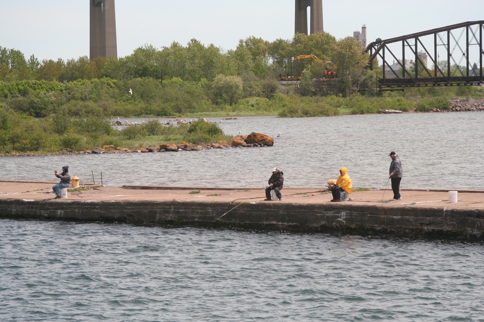
And the requisite shot of the fishermen in this part of the country. Looked cold out there.

Getting ready to enter the locks. Notice Canadian flag on the left side of the locks.

Part of a park located on the Canadian side of the return locks.

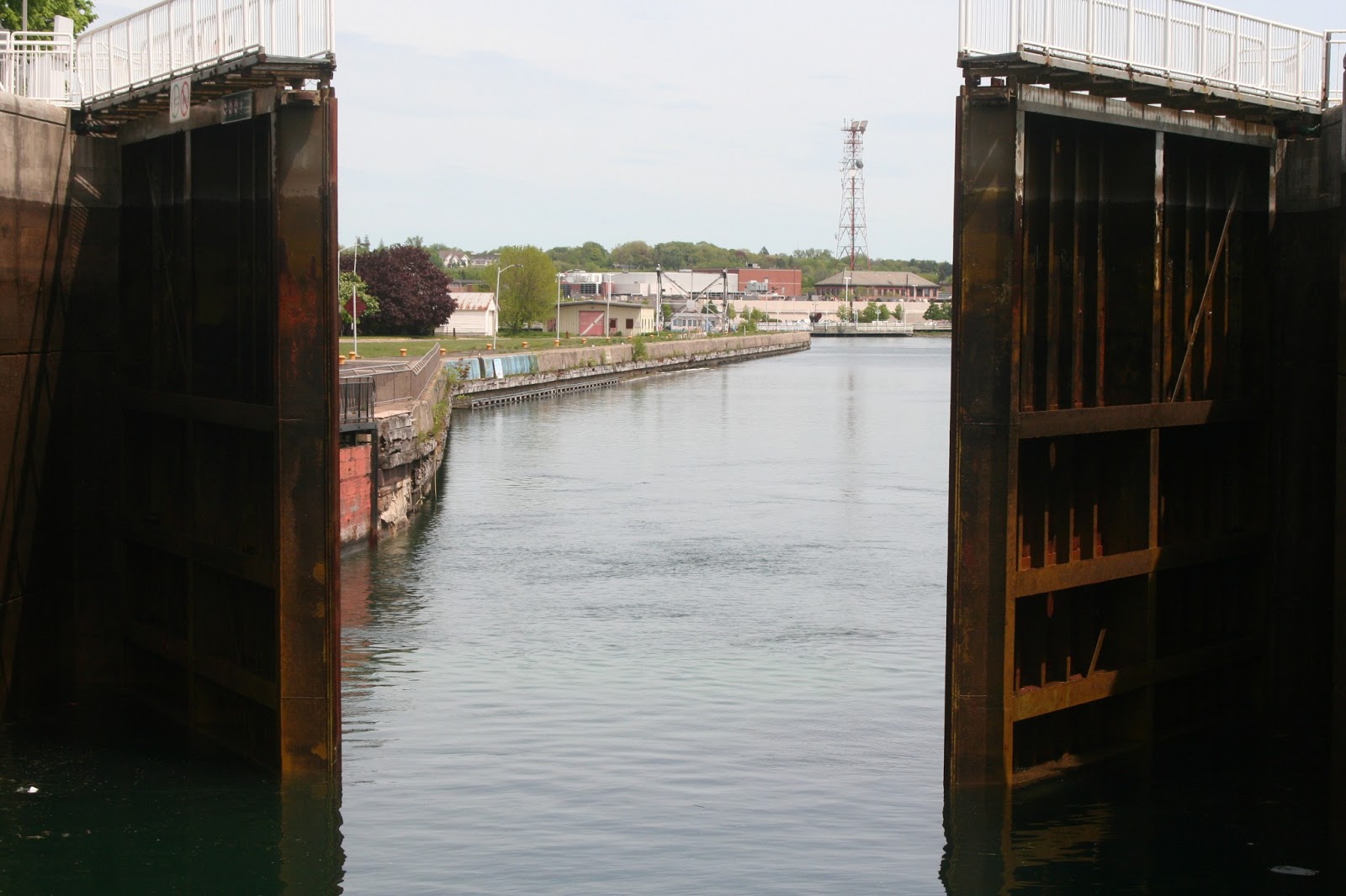
We're in the locks now, gates closed behind us. Water level now has to drop 21-ft to match the water level on the other side of that gate. I know it looks deceptive, but believe me, the water level on the other side is much lower than in the locks right now.

Water levels going down.....

Gates almost ready to open and allow our passage back into Lake Huron.

Man, it took FOREVER for this set of gates to open. Argh.........
Okay, almost ready to re-enter Lake Huron -- at last!

Gate closed all the way -- we can now proceed.

Well, would you look at that. Sault Ste. Marie, Ontario, has a Walmart.....

.....and also a Sears store!

SSM, Ontario also has a very nice lakeshore park with an outdoor theater. Very chic!

And SSM, Ontario, also has a museum dedicated to the history of bush planes in Canada. Darn, sure wish I'd brought those passports! This would have been a nice side trip.

Our boat tour of the Soo Locks is just about over as we head to our docking area. A great sightseeing trip -- weather was great -- we learned a whole lot about locks and how they operate -- and got to see some great country. Would highly recommend this tour if anyone is ever in this part of the USA -- we thoroughly enjoyed it!
Tomorrow, 6 June, we plan to leave the Mackinaw City area, cross the suspension bridge over the Mackinaw Straits in the motorhome (pray for no high winds, please), and head west across Michigan's UP. So far, this has turned out to be a great leg of our journey across the top tier of America. Over the next few days -- on our way to Yellowstone National Park for a few days -- we'll cross Wisconsin, Minnesota, North Dakota, and wind our way across much of Montana on I-94 before heading south toward Yellowstone. Check back with us as I'm sure I'll have at least one or two more blog entries concerning our journey across these states. Cheers!
No comments:
Post a Comment